One of the reasons I bought an iPhone in the first place was so I could use Google Maps to navigate San Francisco’s public transit systems. I just started working in the City a couple of years ago and I went and bought an iPhone so I could punch in the address of where I wanted to be and the phone would tell me “go two blocks down and get on the #10 bus (which will be at the bus stop in 3 minutes).” I could even watch the phone’s GPS marker show me where I was so I knew when to get off the bus or MUNI or BART or whatever. I’ve since taken my phone to other cities and I don’t even bother to rent a car if the city has a decent transit system. I can navigate the ‘L’ in Chicago or Portland’s MAX transit using Google Maps.
So I was not happy to hear that Apple was replacing Google Maps on iOS 6 / iPhone5 with their own mapping program that doesn’t support public transit systems the way that Google Maps does. Not only that, they won’t let you download the Google Maps app from the iTunes store because they don’t want it to compete with the Apple Map app.
Luckily there’s an easy work-around that allows you to install Google Maps using a web shortcut:
Start up Safari on your iPhone.
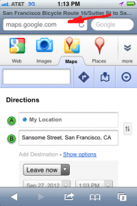
Type “maps.google.com” into the location bar.
Click “yes” if it asks if it can use your location.
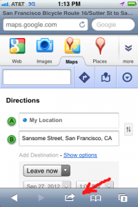
Click the bookmark button at the bottom/middle of the screen.
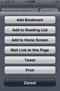
Select “Add to Home Screen”
You should now have a new “Google Maps” app on your iPhone screen that links you directly to maps.google.com. It doesn’t look exactly like the old app, but all of the functions are there, including the ability to plan a route using public transit.
Hope you find this useful.


